National Park · CO · Est. 1915
Rocky Mountain
Overview
Rocky Mountain straddles the Continental Divide about 90 minutes northwest of Denver, and it is the only American national park where you can drive — on pavement, in a sedan — above 12,000 feet. Trail Ridge Road climbs out of ponderosa forest, through subalpine spruce, and out onto a rolling tundra where marmots whistle on cushion-plant meadows and the wind does not stop. In a single afternoon you move through three ecosystems you'd otherwise need a week of hiking to see. The park's 265,000 acres protect some of the most approachable alpine country in North America: mirror-still glacial lakes strung together in chains below the Divide, elk herds that drift through the valleys at dusk bugling in September, moose browsing willow on the park's quieter west side. All of this is why Rocky Mountain is now the third-most-visited national park in the U.S. — and why the NPS has implemented a timed-entry permit system from late May through mid-October. You need one of these reservations in addition to your park pass; buy it on recreation.gov the moment tickets drop for your window, or you will be turned away at the gate. Plan early starts regardless: Bear Lake Road fills up before 8 a.m. in July.
What to See & Do
Trail Ridge Road — the highest continuous paved road in North America
The 48-mile crossing from Estes Park to Grand Lake climbs to 12,183 feet and stays above treeline for 11 miles. Stop at the Rainbow Curve, Forest Canyon, and Gore Range overlooks, and give yourself an hour at the Alpine Visitor Center to walk the short trail up to 12,005-foot Huffer Hill. Go early — afternoon thunderstorms are a real and regular lightning hazard on the tundra. The road is fully open from Memorial Day weekend until the first heavy snow in October.
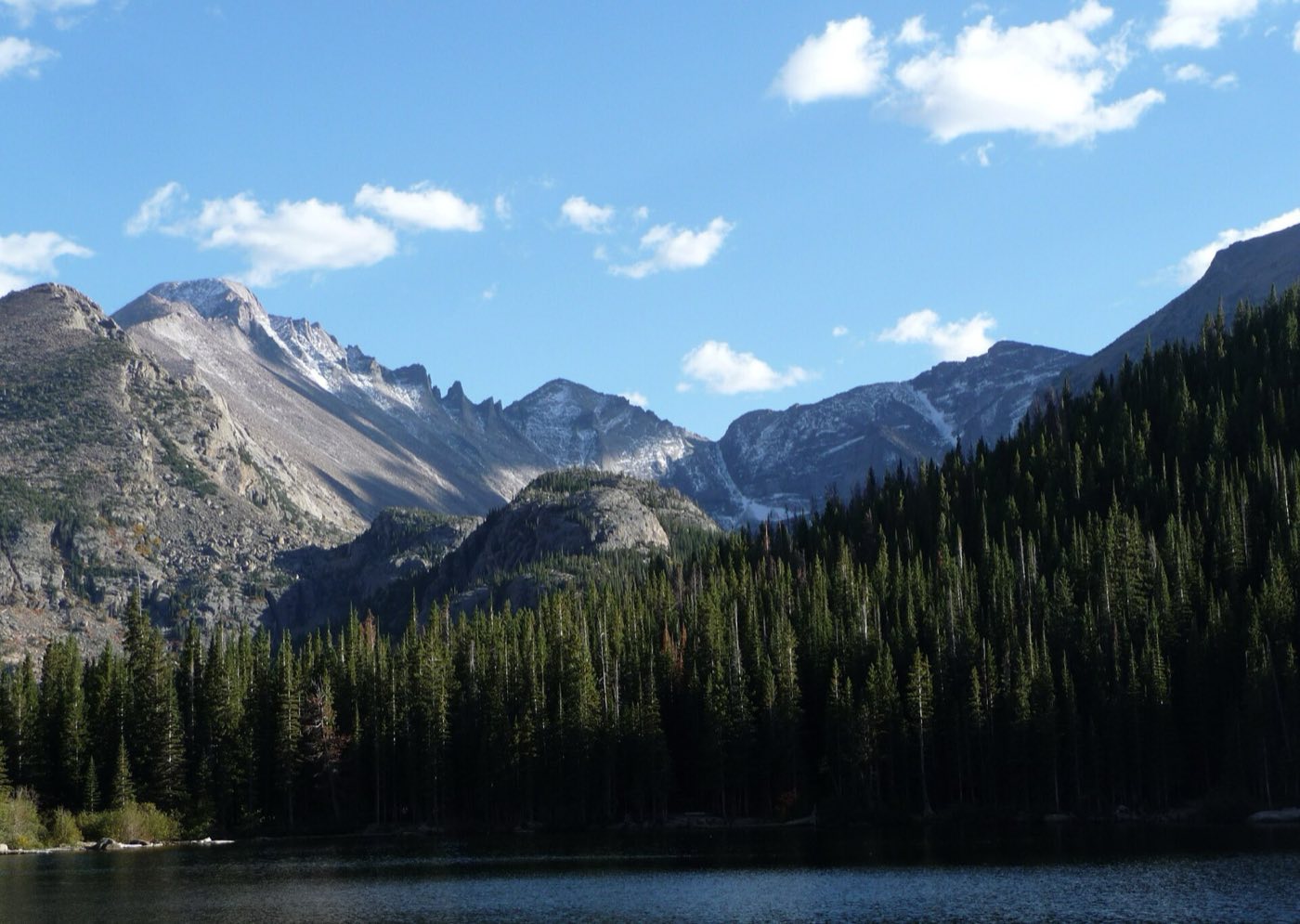
Bear Lake, Nymph Lake, Dream Lake, and Emerald Lake chain
The classic Rocky Mountain day hike. A 3.6-mile round-trip climbs past four lakes set in a granite bowl under Hallett Peak, gaining 700 feet on a well-graded trail. Nymph is half a mile up; Emerald, the payoff, is 1.8 miles in. Bear Lake parking closes by 6 a.m. in summer — use the shuttle from the Park & Ride. The timed-entry permit for Bear Lake Road is separate from the general park permit, so reserve both.
Elk bugling in Moraine Park and Horseshoe Park (September–October)
Every September, the park's elk herds gather in the open meadows of Moraine Park and Horseshoe Park for the rut. Bulls bugle — a long eerie whistle that carries a mile — to challenge rivals and gather harems. Pull into the meadow turnouts at dusk, cut the engine, and listen. Stay 75 feet back and never get between a bull and his cows. Prime weeks are mid-September through early October.
Alpine Visitor Center at 11,796 feet on Trail Ridge Road
The highest visitor center in the NPS system, with a café, ranger talks, and a short paved trail to a tundra overlook. You'll feel the altitude walking up the stairs — pace yourself and drink water. The parking lot is a reliable marmot-spotting pullover and often has bighorn sheep on the ridges above. Open late May through mid-October only, with hours shortening sharply in shoulder season.
Longs Peak summit — the park's highest at 14,259 feet
A 15-mile round-trip with 5,000 feet of gain, including the infamous Keyhole Route and exposed ledges above 13,000 feet — a serious undertaking requiring a 2 a.m. start to be off the summit before afternoon storms. Most climbers turn back at the Keyhole. This is not a casual hike. Practice at 14,000 feet first, check the weather obsessively, and be honest about your experience with exposed scrambling.
Kawuneeche Valley for moose spotting along the Colorado River
The park's west side, accessed from Grand Lake, is quieter, wetter, and the best place in the park to see moose. The Kawuneeche Valley runs along the infant Colorado River, and cows with calves are regularly spotted in willow thickets at the Onahu and Harbison Meadows pullouts. Stay 75 feet back — moose are the most dangerous large mammal in the park. Fall colors in the aspens peak in late September.
Sprague Lake accessible loop with mountain reflections
A 0.8-mile flat, paved-gravel loop around a small lake with a straight-on view of the Continental Divide — Hallett Peak, Flattop Mountain, Otis Peak, and Taylor Peak line up on the horizon. Go at first light for mirror reflections and wildlife (elk often wade in the shallows). It's one of the most accessible trails in the park, suitable for strollers and wheelchairs, and the photo payoff is outsized for the effort.
Getting There & When to Go
Denver International Airport is a 90-minute drive to Estes Park on the east side of the park; from Denver, Grand Lake on the west side is closer to three hours via I-70 and US-40. Late June through September is the full-service window when Trail Ridge Road and all trails are accessible. July is wildflower peak; mid-September through early October is elk rut and aspen gold. Timed-entry permits are required from late May through mid-October — reserve on recreation.gov when your window opens or you'll be turned away. Winter closes the high road but opens snowshoeing on the lower trails.
Where to Stay
There's no in-park lodging, but Estes Park on the east side has the most hotel selection, historic lodges (The Stanley Hotel of Shining fame is here), cabins, and vacation rentals — it's 10 minutes from the Beaver Meadows entrance and 20 from Bear Lake Road. Grand Lake on the west side is smaller and quieter, sitting right at the Kawuneeche entrance and on a beautiful natural lake for kayaking. For in-park camping, Moraine Park and Glacier Basin campgrounds book six months ahead on recreation.gov; Aspenglen is smaller and fills the same day. Timberline camping requires a permit from the Wilderness Office.
Frequently Asked Questions
- Do I really need a timed-entry reservation?
- Yes. From late May through mid-October, timed-entry permits are required in addition to a park pass or entrance fee. The Bear Lake Road corridor requires its own separate permit. Reserve on recreation.gov the moment your window opens — they sell out within minutes during peak summer weekends.
- How high is the altitude and will I feel it?
- The park ranges from 7,500 feet in Estes Park to over 12,000 feet on Trail Ridge Road. Most flatlanders feel some mild altitude effects above 9,000 feet — shortness of breath, headache, trouble sleeping the first night. Drink extra water, skip alcohol the first day, and take Trail Ridge in easy stages with frequent stops.
- When is Trail Ridge Road open?
- Typically Memorial Day weekend through mid to late October, depending on snowfall. Even in summer, the road can close on short notice for thunderstorms, snow squalls, or high winds. Check the park's road status page the morning you plan to drive it, and start early — afternoon storms roll in by 1 p.m.
- Can I see wildlife without a long hike?
- Easily. Moraine Park and Horseshoe Park meadows are reliable for elk, especially at dawn and dusk. The tundra on Trail Ridge Road has marmots and pikas in every rock field. Sprague Lake and Upper Beaver Meadows put you close to elk without leaving the car. Moose are most common on the Kawuneeche Valley side.
Plan Your Visit
Book Nearby HotelsRocky Mountain Planning Guides
Compare focused Rocky Mountain National Park lodging, itinerary, and activity guides before you book.
Itinerary
Rocky Mountain National Park Itinerary
Plan a Rocky Mountain National Park itinerary with Bear Lake, Trail Ridge Road, alpine lakes, Estes Park, Grand Lake, and wildlife viewing.
Where to stay
Where to Stay Near Rocky Mountain National Park
Compare where to stay near Rocky Mountain National Park, including Estes Park and Grand Lake on opposite sides of the park.
Things to do
Things to Do in Rocky Mountain National Park
Explore the best things to do in Rocky Mountain National Park, including Trail Ridge Road, the Bear Lake trail chain, and elk viewing.
Best time to visit
Best Time to Visit Rocky Mountain National Park
Compare the best time to visit Rocky Mountain National Park by road access, wildflowers, elk rut, and timed-entry permits.
Have you visited Rocky Mountain?
Track all 63 national parks on your map