Namibia
- Capital
- Windhoek
- Population
- 2.6M
- Currency
- NAD
- Languages
- English
Overview
One of Africa's most visually dramatic countries, Namibia runs from the cold Atlantic Skeleton Coast across the world's oldest desert to the salt pan of Etosha and the canyon country of the south. Travelers come for sunrise at Sossusvlei's blood-red dunes, desert-adapted elephant tracking in Damaraland, shipwreck-strewn beaches where the Benguela fog meets the Namib, and a national road network clean enough that an independent self-drive is the default way to see the country. What sets Namibia apart is the scale and the silence. You can drive four hours on gravel and pass three cars. A zebra crossing the road is an event. At Sossusvlei the dunes rise 300 meters out of a pan-flat valley in shades of orange, rust, and apricot that change by the hour, and the only sound is wind rearranging the top grains. This is a country for photographers, geologists, insomniacs, and anyone who finds crowds exhausting — the whole nation has fewer people than a mid-sized American city, and most of them live in Windhoek. Namibia rewards the self-sufficient. The roads are mostly well-signed, the lodges have cell signal or satellite Wi-Fi, and a 4x4 rental with a rooftop tent is a rite of passage for visitors from Europe and South Africa. A classic two-week loop covers Windhoek, Sossusvlei, Swakopmund on the coast, Damaraland, Etosha, and the Waterberg Plateau on the way back. Book lodges at least three months out for May through October — the country is big but the best places are few, and they fill.
Things to Do
Sossusvlei and Deadvlei red dunes
The iron-oxide dunes at Sossusvlei are the image most people carry of Namibia — some 300 meters tall, colored by 5 million years of weathering, changing shade every fifteen minutes through sunrise. Enter the park gate at Sesriem at opening (sunrise-dependent, 5:30 to 6:45 a.m.), drive the 60 kilometers to the 2x4 car park, and walk or catch a shuttle the last five kilometers to Deadvlei — the bone-white clay pan studded with 900-year-old dead camel-thorn trees photographed in every Namibia feature ever written. Climb Big Daddy or Dune 45 if your lungs allow.
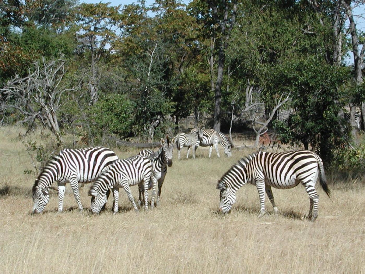
Etosha National Park game drives
A 22,000-square-kilometer park built around a vast silver salt pan visible from space, Etosha is self-drive safari country. In dry season (July to October) animals queue at the waterholes — elephant, giraffe, zebra, springbok, oryx, black rhino, and usually lion if you sit still long enough. Fence off three nights minimum across two or three of the park rest camps (Okaukuejo for the floodlit waterhole, Halali for the view, Namutoni for the old German fort feel). Keep to the tracks, keep your speed low, keep windows up around elephants.
Skeleton Coast shipwrecks and seal colonies
The 500-kilometer stretch of coast north of Swakopmund is one of the most haunting shorelines anywhere — a cold fog-bound beach where over a thousand shipwrecks decay into the sand and 100,000 Cape fur seals haul out at Cape Cross. The southern section to Terrace Bay is accessible by self-drive on a permit; the far north is reserved for fly-in safaris. Bring warm layers even in summer; the Benguela current drops air temperatures ten degrees cooler than inland, and the fog rolls in by mid-morning.
Fish River Canyon — Africa's largest canyon
In the far south near the Orange River, the Fish River has carved a 160-kilometer, 550-meter-deep canyon into a sandstone-and-basalt plateau — the second-largest in the world after the Grand Canyon. Main Viewpoint and Hikers Viewpoint give you the full scale in under an hour; the five-day, 85-kilometer trek along the canyon floor (May to September only, permit required) is one of Africa's great wilderness hikes. Book the Ai-Ais hot springs resort for a night of recovery at the downstream end.
Spitzkoppe granite peaks
A 700-million-year-old granite massif that rises out of the desert plains south of the Brandberg, looking like something off a different planet. The main Spitzkoppe peak tops out at 1,728 meters, and the surrounding koppies hold 2,000-to-4,000-year-old San rock paintings at Bushman's Paradise and the Pontok Mountains. The community campground, run by the local Damara community, is the one to use — camp pitches sit between the rock formations, and the stars are extraordinary.
Damaraland desert-adapted elephants and rhinos
A dry semi-desert region between the Skeleton Coast and Etosha where small populations of desert-adapted elephants and black rhinos have evolved to survive on minimal water — walking 70 kilometers between river-bed food sources, remembering every waterhole for 60 years. The rhinos are tracked on foot by community-run conservancies (Save the Rhino Trust, Palmwag Concession) — one of the most responsible wildlife experiences on the continent. Combine with the Twyfelfontein rock engravings, Namibia's first UNESCO site.
Swakopmund adventure town and sand dunes
A German colonial relic on the coast — bakery-cafes serving apfelstrudel, a 1905 lighthouse, Bavarian street names, and all of it wrapped in salt air and Namib fog. Swakopmund is where self-drivers resupply, eat a proper steak at the Tug, and sign up for the adventure circuit: quad biking over the dunes, sandboarding, skydiving over where desert meets ocean, or a dolphin-and-seal catamaran cruise from Walvis Bay twenty minutes south. Two nights is plenty; the town is mostly a break from the gravel road.
Kolmanskop ghost town
Ten kilometers east of Lüderitz on the southern coast, a 1908 diamond-rush town sits half-buried under advancing dunes — ornate German colonial houses with sand spilling through doorways, up staircases, out of fireplaces. The mines closed in the 1950s and the desert has been reclaiming the buildings ever since. Photography permits (separate from the entrance ticket) let you enter before the regular tours arrive at 9:30; the low early light through dune-filled doorways is what you came for.
When to Go
May through October is the dry winter season and the prime window — clear skies, cool nights, animals concentrated at Etosha waterholes, and manageable daytime temperatures of 20 to 28°C. June and July can drop below freezing at night in the desert, so pack layers. November through April is the green summer season with afternoon thunderstorms, hot days (easily 35 to 40°C), and fewer crowds; Sossusvlei is still stunning, but Etosha wildlife disperses as surface water becomes plentiful. The birding is best in the green season when migrants arrive. Sossusvlei itself is stunning year-round — only choose your crowd preference and heat tolerance.
Getting Around
Self-drive is the standard way to travel Namibia and the country is set up for it — main roads are tarred between Windhoek, Swakopmund, Otjiwarongo, and Keetmanshoop, while the rest is well-graded gravel that demands slower speeds (80 km/h max) and awareness of soft patches and washboard. A 4x4 isn't strictly required for the classic loop but makes the Skeleton Coast, Kaokoland, and soft-sand stretches near Sossusvlei far easier. Rental agencies from Windhoek airport equip their vehicles with spare tires, a compressor, jack, and often a rooftop tent. Distances are long — allow a full driving day between regions — and fuel stops thin out past Sesriem and north of Etosha. Keep the tank above half, watch for kudu at dawn and dusk, and brief yourself on gravel-road skid recovery before leaving the tar.
Cost & Currency
Namibia uses the Namibian dollar (NAD), pegged 1:1 to the South African rand, and both currencies circulate freely inside the country (rand is accepted everywhere; Namibian dollars only spend inside Namibia, so don't carry them out). Self-drive travel runs around 150 to 250 US dollars per day for two including a mid-range 4x4 rental, fuel, and camping or mid-range guesthouse pitches. A plate of kudu steak at a roadhouse runs NAD 150 to 250, a lodge dinner 400 to 600, and mid-range lodge rooms 1,500 to 3,500 NAD per night including breakfast. Upscale safari lodges in Damaraland and private Etosha concessions run 400 to 800 US dollars per person all-inclusive. Cards are accepted at lodges, fuel stations, and Windhoek or Swakopmund restaurants; carry cash for small towns, park gates, and campsite fees. Tipping is customary — 10% at restaurants, NAD 50 to 100 per day to guides and trackers.
Frequently Asked Questions
- Do I need a visa to visit Namibia?
- Most Western nationalities (US, UK, EU, Canada, Australia) can enter visa-free for 90 days per year — just arrive with a passport valid six months beyond your stay, two empty pages, and proof of onward travel. Check entry requirements with the Namibian embassy before you travel; regulations change periodically, including recent changes around advance online registration for some nationalities.
- Is self-driving Namibia safe for first-timers?
- Yes, for confident drivers willing to go slow on gravel. Namibia has one of the lowest crime rates on the continent, distances are clearly signed, and rental companies brief you thoroughly before handover. The real risks are speeding on loose gravel (sudden sand patches, washboard, animals on the road) and single-vehicle rollovers — keep it under 80 km/h on gravel, no phone use, and don't drive after dark if you can avoid it.
- Do I need malaria prophylaxis?
- Only for certain regions and seasons. The Zambezi (Caprivi) Strip in the far northeast and Etosha's northern edge during the wet season (November to April) carry malaria risk — take antimalarials for those trips. The central highlands, Sossusvlei, Damaraland, and the southern desert are malaria-free year-round. Check with a travel clinic based on your specific itinerary.
- How long should I plan for a first trip to Namibia?
- Two weeks is the sweet spot for a first visit — enough to cover Sossusvlei, Swakopmund, Damaraland, and Etosha at a pace that lets the landscapes settle in. Ten days is achievable if you cut Damaraland or the coast. Under a week means picking one region and staying put; the distances don't reward short trips.
- Can I see the Big Five in Namibia?
- Four of the five, reliably. Etosha holds lion, elephant, rhino (both white and black), and leopard — though leopards are shy. Buffalo aren't found in the main parks but are in the Zambezi region in the far northeast. Etosha is the single best park for variety, while Damaraland's desert-adapted populations offer a rarer, more intimate experience than the classic East African safari model.
Plan a Trip to Namibia
Have you been to Namibia?
Track 195 countries, 50 states & 63 national parks on your map