National Park · AZ · Est. 1994
Saguaro
Overview
Saguaro protects the most iconic stretch of Sonoran Desert on the planet — the one in the cartoons, the Westerns, the roadrunner cartoons — and it happens to be split across the east and west edges of Tucson, Arizona, with the city tucked in the middle. The east unit (Rincon Mountain District) is older, taller, and more forested on its mountain flanks; the west unit (Tucson Mountain District) is flatter, denser with giant cacti, and the one most visitors mean when they say they've been. Either is a quick drive from downtown Tucson. The stars here are the saguaros themselves — slow-growing columns that don't sprout their first arm until they're around 75 years old and can live to 200, reaching 40 feet tall and weighing several tons when swollen with monsoon rain. They're only one of dozens of charismatic desert plants around you: ocotillo, cholla, barrel cactus, palo verde, prickly pear. Come at dawn or dusk — the midday sun flattens everything and cooks the trails. A morning drive through the Cactus Forest Loop, a short hike before it gets hot, coffee back in Tucson, and a sunset at Valley View Overlook is a better day than trying to push through the heat.
What to See & Do
Cactus Forest Loop Drive and cycling route in the Rincon district
An 8-mile paved one-way loop through the east unit's densest saguaro stands, with pullouts for short interpretive walks (Desert Ecology Trail, Freeman Homestead). It's the best introduction to the park if you only have a morning. Cyclists love it in the cool hours — rolling, shoulder-less, low-traffic, and closed to commercial vehicles. Gates open at 7 a.m. Go then, before the light flattens and the tarmac starts to shimmer.
Signal Hill petroglyphs — ancient Hohokam rock art
A quarter-mile walk up a small hill in the west unit to a cluster of basalt boulders covered in spirals, animals, and human figures carved by the Hohokam people roughly 800 years ago. The interpretive plaques are minimal on purpose — you're meant to stand there and look. Combine it with a picnic at the adjacent tables and a drive down the Bajada Loop. Go in late afternoon when the side light makes the carvings jump off the rock.
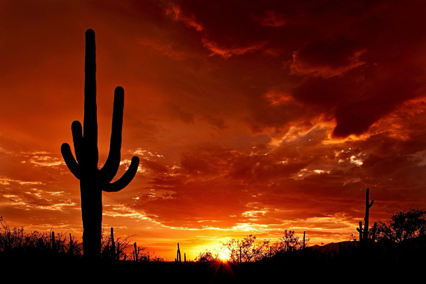
Valley View Overlook Trail at sunset with saguaro silhouettes
A 0.8-mile out-and-back in the west unit, flat with a short dip and climb, ending on a ridge that looks west across a forest of saguaros toward Avra Valley and the Silver Bell Mountains. The silhouetted cactus-at-sunset photo you have in your head was probably taken here. Arrive 30 minutes before sunset, bring a headlamp for the walk back, and watch for rattlesnakes on the trail in warmer months.
Tanque Verde Ridge Trail for Sonoran Desert panoramas
A serious climb in the east unit — 6 miles round-trip to Juniper Basin with 1,800 feet of gain, or a shorter 2-mile out-and-back to a first overlook that still pays off in big views. The trail ascends out of the saguaro zone into oak and pinyon, a rare chance to feel the desert's vertical transitions in one morning. Start at dawn with two liters of water minimum, and turn around at the first overlook if the heat is already climbing.
King Canyon Trail to a desert waterfall after rains
In the west unit, a 3.5-mile round-trip up a rocky desert wash to a small seasonal pool called Mam-A-Gah and sometimes a trickling waterfall when winter rains have been good or after monsoon storms. The route passes more petroglyphs and old mining relics. It's the west unit's best real hike, less crowded than the drives, and a good taste of what the Rincons deliver on the other side of town.
Desert Discovery Nature Trail in the Tucson Mountain district
A 0.5-mile paved ADA-accessible loop just off the Red Hills Visitor Center parking lot, with interpretive signs keyed to the Sonoran species along the way. The perfect first stop for getting your bearings — by the time you've walked it, you'll recognize saguaro, prickly pear, cholla, ocotillo, mesquite, palo verde, and creosote by name. Good for kids, strollers, wheelchairs, and a sanity break on a hot afternoon.
Saguaro blooms in late April and May — the state flower
For about three weeks every spring, saguaros open creamy-white flowers at the tips of their arms — Arizona's state flower, pollinated at night by lesser long-nosed bats and by day by white-winged doves and bees. The blooms open at night and wilt the following afternoon, so each flower is a one-day show. Early May mornings in either unit are prime; bring binoculars to see the blooms up the tall cacti.
Getting There & When to Go
Tucson International Airport is 15 minutes from the east unit and 30 from the west — you'll likely drive through town between them. October through April is the comfortable hiking window, with daytime highs in the 60s and 70s and cool nights. Late April and May bring the saguaro bloom, the state flower, atop the tall cacti. Summer (June–September) is genuinely dangerous in the middle of the day — temperatures regularly top 105°F — but the monsoon season (July–September) produces dramatic afternoon thunderstorms and a quick green-up of the desert. Either unit is a year-round dawn hike if you start early enough.
Where to Stay
There is no lodging or campground inside Saguaro's boundaries — all stays are outside the park. Tucson itself is your base, and where you stay matters: the west side (near the Tucson Mountain unit) puts you closer to Saguaro West, the Desert Museum, and Old Tucson, with resorts like the White Stallion Ranch and JW Marriott Starr Pass; the east side (near the Rincon unit) is closer to Saguaro East, Sabino Canyon, and the Rincon foothills, with Tanque Verde Ranch and Loews Ventana Canyon. Downtown Tucson sits in the middle with historic inns, casitas, and an excellent food scene.
Frequently Asked Questions
- Which unit of Saguaro should I visit first?
- If you only have one morning, go west (Tucson Mountain District) — the saguaros are denser, the Cactus Forest Loop is shorter, and it adjoins the Arizona-Sonora Desert Museum. If you have a full day and want real hiking, the east unit (Rincon Mountain District) has longer trails and more elevation. Most visitors split their time and do both.
- Is it safe to hike in summer?
- Only if you start at dawn, turn around by 9 a.m., and carry plenty of water. Summer highs regularly exceed 105°F and the rocks radiate heat long after sunset. The NPS records heat-related rescues every year. Dawn hikes are the right move; midday is for shaded courtyards and museum visits in town.
- When do saguaros bloom?
- Late April through early June, peaking in May. Flowers open at night and close the following afternoon, so each individual bloom lasts roughly a day. Look for creamy-white flowers clustered at the tips of the arms and the crown. The timing varies year to year with winter rainfall, so check with the visitor center.
- Do I need to worry about rattlesnakes?
- Western diamondbacks and a handful of other species are active from spring through fall, mostly at dawn and dusk and along trails and washes. Watch where you put your hands and feet, don't step over rocks or logs without looking first, and give any snake you see at least 5 feet of distance. Bites are rare when visitors pay attention.
Plan Your Visit
Book Nearby HotelsHave you visited Saguaro?
Track all 63 national parks on your map