National Park · MI · Est. 1940
Isle Royale
Overview
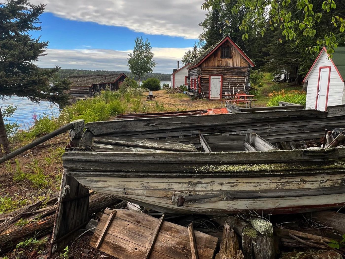
Isle Royale is a long, narrow island — 45 miles by 9 — in the northwest corner of Lake Superior, closer to Canada and the Minnesota mainland than to Michigan. You get there by ferry or seaplane out of Houghton or Copper Harbor, Michigan, or Grand Portage, Minnesota. Once on the island there are no roads, no cars, no cell service, and no way off except the same boat or seaplane that brought you in. The park closes entirely from November through mid-April. Attendance hovers around 25,000 visitors a year, fewer than Yellowstone gets on a busy summer Saturday. What you trade the convenience for is wilderness that genuinely feels wild. The Greenstone Ridge spine runs the length of the island through spruce and birch forest over bare rock outcrops. Moose browse the shorelines. A small wolf population still hunts the interior in the longest-running predator-prey study in ecology — researchers have watched these animals for over 60 years. Paddle out of a quiet cove in the morning mist, cross a shoreline where the only sounds are your paddle strokes and loons calling, and you start to understand why people who come here once plan to come back.
What to See & Do
Greenstone Ridge Trail — 40-mile backbone hike across the island
The Greenstone Ridge Trail runs the spine of Isle Royale from Windigo at the southwest end to Rock Harbor at the northeast, crossing the highest points on the island through spruce and birch forest with periodic open rock ledges. Most hikers plan 4 to 6 days and connect the ridge with side trails down to Chickenbone and Lake Desor. Ferries land you at either end and pick you up at the other. Water is scarce along the ridge itself — refill and filter from interior lakes.
Moose sightings along lakeshores and inland trails
About 1,500 moose live on Isle Royale — one of the densest populations in North America and easily the best place to see one in the wild. They graze in the shallows of Hidden Lake, Chickenbone Lake, and Siskiwit Bay's edges, especially at dawn and dusk. Stay 50 yards back — bulls in September rut and cows with calves in May can be aggressive. Listen for the splash before you see the animal; they wade for aquatic plants.
Kayaking the rocky coastline and hidden coves
The island's irregular shoreline, protected inlets, and countless small satellite islands make it one of the best sea kayak destinations in the Midwest. Rent from the concessioner at Rock Harbor or bring your own on the ferry. Stick to the inside passages — Superior's open water can build six-foot swells with little warning. Paddle out of Rock Harbor toward the Edwards Island chain, or explore the quieter coves around Belle Isle and McCargoe Cove for secluded campsites.
Lookout Louise for panoramic views of the Canadian shore
Lookout Louise is a short but steep climb off Hidden Lake near the island's northeast end, reached most easily by water taxi from Rock Harbor. From the bare rock summit you can see the Canadian shore 18 miles north and most of the northeast end of Isle Royale itself — the single best vantage point on the island. Go on a clear day; the view is unremarkable in fog, which is frequent. Pack a lunch and linger.
Scoville Point loop trail at Rock Harbor
Scoville Point is the 4.2-mile loop hike right out of the Rock Harbor lodge area — the one to do if you only have a few hours on the island. The trail works through mixed birch and conifer forest out to a bare rock point jutting into Lake Superior, with views of Middle Islands Passage. Moose sightings here are common, and loons on the bay are constant. Easy terrain, well signed, and a good introduction to the island's character.
Suzy's Cave sea arch near Rock Harbor
Suzy's Cave is an ancient sea arch carved when Lake Superior's water level stood much higher after the last ice age, now stranded above the current shoreline. The cave is a short 3.5-mile roundtrip hike from Rock Harbor, passing through forest and over rocky outcrops. The arch itself is small but photogenic, and the walk to it is quintessential Isle Royale — quiet, rocky, and likely moose-producing. Combine it with the Tobin Harbor trail for a longer half-day loop.
Diving on historic Lake Superior shipwrecks
Ten major shipwrecks lie in the cold, clear waters around Isle Royale, several in shallow enough water that advanced divers can explore them. The SS Algoma, SS America, and SS Emperor are the classics — remarkably well preserved by Superior's 40-degree water. Dives are cold-water, advanced, and require a boat; the park concessioner in Rock Harbor and a handful of Minnesota charter operators run dive trips in summer. A drysuit certification is essentially mandatory.
Getting There & When to Go
Getting to Isle Royale requires a boat or seaplane and a full travel day in each direction. The Ranger III departs Houghton, Michigan, on a 6-hour crossing to Rock Harbor twice a week; the Isle Royale Queen IV runs faster from Copper Harbor. The Sea Hunter III runs from Grand Portage, Minnesota, to Windigo on the southwest end in about 1.5 hours. Seaplane service from Houghton or Grand Marais cuts the trip to 35 minutes but costs more and is weather-dependent. The park is open mid-April through October; ferries and lodging run mid-June through early September. July and August give you the warmest weather and calmest Superior crossings, but also the most bugs — mosquitoes and black flies peak in June and July.
Where to Stay
Rock Harbor Lodge on the northeast end is the only developed lodging on the island — modest rooms and small housekeeping cottages with a restaurant, marina, and camp store. It books out 6 to 9 months ahead for summer weekends. Everyone else camps: the park runs 36 campgrounds with three-sided shelters and tent pads, all free with your backcountry permit. You can't reserve sites — it's first-come-first-served, and busy hubs like Daisy Farm and Three Mile fill up on July weekends. Arrive early, be ready to double up in a shelter with other hikers, and plan a flexible itinerary. On the mainland, stay in Houghton, Copper Harbor, or Grand Portage before your ferry departs.
Frequently Asked Questions
- How do I actually get to Isle Royale?
- Three ferry routes and two seaplane routes, all seasonal. The Ranger III from Houghton, Michigan (6 hours) is the largest and cheapest; the Isle Royale Queen IV from Copper Harbor (3.5 hours) is faster; the Sea Hunter III from Grand Portage, Minnesota (1.5 hours) is the quickest boat. Seaplanes fly from Houghton or Grand Marais in about 35 minutes.
- Do I need a permit to visit?
- Yes — every overnight visitor needs a camping permit, obtained free at the ranger station when you arrive. There's also a $7 per person per day user fee. Day visits are allowed but rare given the travel time. Groups of 7 or more need advance reservations.
- Are there actually wolves on the island?
- Yes — after the original population crashed to a single breeding pair, the park relocated 19 wolves from Canada and Michigan between 2018 and 2019 to restore the predator-prey balance. The population now numbers around 30 animals in several packs. You almost certainly won't see one — they avoid humans — but you may hear howls at night.
- Will I get cell service on the island?
- No. There is no cell coverage, no wifi for visitors, and no way to charge devices except at Rock Harbor Lodge. The ranger stations have satellite phones for emergencies only. Tell someone your itinerary before you leave, pack a paper map, and enjoy the unplugged reality of a park that genuinely means it.
Plan Your Visit
Book Nearby HotelsHave you visited Isle Royale?
Track all 63 national parks on your map